TomTom 2015 Annual Report Download - page 23
Download and view the complete annual report
Please find page 23 of the 2015 TomTom annual report below. You can navigate through the pages in the report by either clicking on the pages listed below, or by using the keyword search tool below to find specific information within the annual report.-
 1
1 -
2
-
3
-
4
-
5
-
6
-
7
-
8
-
9
-
10
-
11
-
12
-
 13
13 -
 14
14 -
 15
15 -
 16
16 -
 17
17 -
 18
18 -
 19
19 -
 20
20 -
 21
21 -
 22
22 -
 23
23 -
 24
24 -
 25
25 -
 26
26 -
 27
27 -
 28
28 -
 29
29 -
 30
30 -
 31
31 -
 32
32 -
 33
33 -
34
-
35
-
36
-
37
-
38
-
39
-
40
-
41
-
42
-
43
-
44
-
45
-
46
-
47
-
48
-
49
-
50
-
51
-
52
-
53
-
54
-
55
-
56
-
57
-
58
-
59
-
60
-
61
-
62
-
63
-
64
-
65
-
66
-
67
-
68
-
69
-
70
-
71
-
72
-
73
-
74
-
75
-
76
-
77
-
78
-
79
-
80
-
81
-
82
-
83
-
84
-
85
-
86
-
87
-
88
-
89
-
90
-
91
-
92
-
93
-
94
-
95
-
96
-
97
-
98
-
99
-
100
-
101
-
102
-
103
-
104
-
105
-
106
-
107
-
108
-
109
-
110
-
111
-
112
-
113
-
114
-
115
-
116
-
117
-
118
-
119
-
120
-
121
-
122
-
123
-
124
-
125
-
126
-
127
-
128
-
129
 |
 |

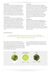
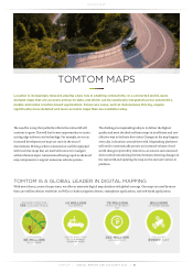
OVERVIEW
TOMTOM / ANNUAL REPORT AND ACCOUNTS 2015 / 22
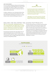
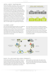
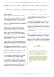
EMBEDDED AND ONLINE NAVIGATION USE SAME COMPONENTS
IN 2015, WE HAVE INTEGRATED THE NDS MAP FORMAT into our
navigation software on device-based and server-based navigation applications
2015 MILESTONES
We embraced the industry Navigation Data Standard (NDS) map
format, and delivered a new set of navigation products based on
this format in 2015. We completed our switch from the state-of-
the-art TomTom Classic (TTC) run-time maps format to NDS; a
complete technology renewal with latest architectural designs
and a new and more-easily maintained code base. Subsequently,
we rolled out competitive and novel features in our NavKit-based
navigation products.
A key factor is that our new NDS-based code supports both
embedded systems and online navigation services (Online
Routing, Online Search and Online Maps). These products are
built on the same code base, which gives them a consistent,
robust API logic. The move to NDS has improved our own
efficiency, allowing us to increase the pace of development and
to roll out NDS-based online navigation services and embedded
navigation at the same time. NDS allows our new products the
flexibility to be paired with a wide range of partners’ products,
based on their specific requirements.
In 2015, we launched the TomTom MyDriveApp application and
the MyDriveWeb website, both running on our all-new NDS-
based navigation engines. We also launched NavCloud, a syncing
and sharing service. NavCloud allows users to synchronise their
favorites, home and work, current destination, and routes across
their mobile devices and computers. All of these components are
available to consumers, and we offer white-label connected
navigation components to automotive and licensing customers.
We made good progress with our newly developed map
visualisation engine for NDS. The map visualisation was built
from the ground up, and offers impressive features including
support for multi-display, cross platform (iOS, Android)
interactive map rendering. The new technology offloads more
object rendering to the Graphics Processing Unit, which allows
superior scalability. This greatly improves the responsiveness
and crispness of the user interface, for example when zooming
in or out a map view; due to the vector-based graphics, zooming
avoids blurry map tiles and provides a very smooth experience
for the user. This technology will offer the driver lane-level
guidance and 3D visualisation of bridges and tunnels. The
customer interest in the new map visualisation solution is high
and we are already integrating with OEM platforms for
demonstration.
We delivered a free text search engine for NDS this year. This
feature required development of new algorithms to enable a
more flexible search paradigm. Free text search means that a user
can search without using the structured format of listing the
country, city, street name and address number. As with the other
new NDS-based features, the same engines are used for
embedded and online products such as the MyDriveApp and the
MyDriveWeb website.
Finally, we enriched our industry-leading map matching
algorithms, which now outsmart traffic and get customers there
faster. These work independently for both TTC and NDS. Map
matching is the feature that shows the user’s location on the
map. To do this, we use several last known positions instead of
only one, to show more accurately the user’s location, regardless
of whether there are overpasses or other obstructions blocking
the GPS signal.
BUSINESS OUTLOOK
We will soon release Decision Point Navigation based
on NDS NavKit, which will add an innovative
dimension to dynamic routing to outsmart traffic and
real-time obstructions. We are well positioned to
continue leading in NDS navigation software for
superior navigation, search and map display.
Our connected navigation solutions and strategic
research partnerships will continue to leverage real-
time data sets to provide innovative solutions for
tomorrow’s problems, including megacity traffic,
Autonomous Driving, urban smart mobility, and
pollution.