Garmin 2005 Annual Report Download - page 16
Download and view the complete annual report
Please find page 16 of the 2005 Garmin annual report below. You can navigate through the pages in the report by either clicking on the pages listed below, or by using the keyword search tool below to find specific information within the annual report.-
 1
1 -
2
-
3
-
4
-
5
-
 6
6 -
 7
7 -
 8
8 -
 9
9 -
 10
10 -
 11
11 -
 12
12 -
 13
13 -
 14
14 -
 15
15 -
 16
16 -
 17
17 -
 18
18 -
 19
19 -
 20
20 -
 21
21 -
 22
22 -
 23
23 -
 24
24 -
 25
25 -
 26
26 -
27
-
28
-
29
-
30
-
31
-
32
-
33
-
34
-
35
-
36
-
37
-
38
-
39
-
40
-
41
-
42
-
43
-
44
-
45
-
46
-
47
-
48
-
49
-
50
-
51
-
52
-
53
-
54
-
55
-
56
-
57
-
58
-
59
-
60
-
61
-
62
-
63
-
64
-
65
-
66
-
67
-
68
-
69
-
70
-
71
-
72
-
73
-
74
-
75
-
76
-
77
-
78
-
79
-
80
-
81
-
82
-
83
-
84
-
85
-
86
-
87
-
88
-
89
-
90
-
91
-
92
-
93
-
94
-
95
-
96
-
97
-
98
-
99
-
100
-
101
-
102
-
103
-
104
-
105
-
106
-
107
-
108
-
109
-
110
-
111
-
112
-
113
-
114
-
115
-
116
-
117
-
118
-
119
-
120
 |
 |

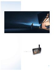
Answering mariners’ call for exceptional chart detail without the need for downloads or multiple data cards,
Garmin introduced two new chartplotters with preloaded BlueChart®cartography. The GPSMAP 192C and 198C
Sounder are ideal for mariners who log a lot of miles on their boats or who don’t have access to a PC to load
individual charts. Each unit has built-in BlueChart detail for the entire coastal United States, including Alaska
and Hawaii, and will accept preprogrammed cards for other areas such as Canada, the Bahamas or inland
lakes. The popularity of the Garmin Marine Network™drove the introduction of an additional network-
enabled plotter, the GPSMAP 3005C. The 3005C has similar network capabilities to the larger 3006C and
3010C plotters, including the ability to interface with radar, sonar and satellite weather/audio.
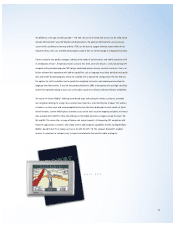
Monitoring rapidly changing weather patterns at sea is vital to boaters and fishing enthusiasts, and now they
can have this information and more from a portable plotter. The GPSMAP 376C offers XM WX Satellite Weather
data such as NEXRAD radar, wave direction and height, surface temps and more overlaid on the unit’s sunlight-
readable color display. Weather information is also available when the 376C is used as a land navigator.
Sonar features can be added with the GSD™20 remote sounder.
In 2005, 11 new boat OEMs signed agreements to offer Garmin fishfinders and GPS chartplotters as standard
or optional equipment. The list includes a mixture of inland (freshwater) and offshore (saltwater) builders including
Crestliner, Cruiser Yachts, Glacier Bay Catamarans, Key West Boats, Lund, Mastercraft and Thunderjet Boats.
15